History of East Greenwich
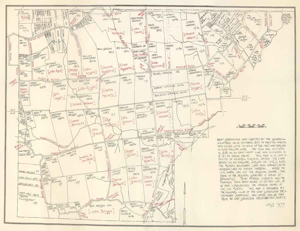
East Greenwich was created by the General Assembly on 31 October 1677 to provide farms and house lots to each of 48 men who served in King Philip’s War. The Town was divided in 1678 on an East-West line into Divisions I & II.
This map is a composite of several surveys dated 1716 (one based on an earlier survey of 1712) and the roads, boundary lines and names (with acreage) are as shown thereon. Where the 1716 owner not the original owner, the name of the original grantee is showing in [Brackets]. Some modern streets and the highways have been added in dotted line & we have superimposed the modern names of our old roads. This map is prepared by the founds club of the East Greenwich Tercentenary Commission. July 1977
There is a larger version of this map in the Library/Archive member's section.